Rudraprayag Travel Guide
Rudraprayag is busiest as a Char Dham staging town, so the one thing to plan around is the shrine season: for 2026 Kedarnath opened about 22 April and Badrinath about 23 April...
When to visit Rudraprayag, and the Char Dham season
Rudraprayag is busiest as a Char Dham staging town, so the one thing to plan around is the shrine season: for 2026 Kedarnath opened about 22 April and Badrinath about 23 April, with the season running to around mid-November. Complete the free registration before you set out.
- May to June, then September to OctoberThese are the most settled windows for the Char Dham route, with clearer skies and gentler weather. Rudraprayag sits low at about 895 m, so days here are pleasant; the cold and the altitude come higher up toward the shrines, so carry warm layers for the onward legs even in summer, as the weather at Kedarnath can change suddenly.
- Avoid the peak monsoonJuly to early September brings heavy rain to this part of Uttarakhand, with a real risk of landslides and road blocks on the routes to Kedarnath and Badrinath, and the yatra is sometimes halted for a day or two when rain is heavy. If you must travel then, keep the plan flexible and watch the weather and road updates closely.
- The shrine season sets your datesFor 2026 Kedarnath opened on about 22 April and Badrinath on about 23 April, and the season runs to around mid-November, with current reports putting Kedarnath's close at about 11 November and Badrinath's at about 13 November. The closing dates are formally declared on Vijayadashami, and all of them are fixed afresh each year, so reconfirm with the Badri-Kedar Temple Committee before fixing your travel.
- Rudraprayag itself stays open longerThe town at the sangam is accessible most of the year, so a Rudraprayag night is easy to add even at the shoulders of the season. It is the high shrines above it, Kedarnath and Badrinath, that are open only for roughly seven months, about late April to mid-November, before winter snow closes them.
The free Char Dham registration on the official Uttarakhand portal is mandatory before the route, is Aadhaar-linked, and a QR e-pass is checked on the way to the shrines. Note too that vehicles are banned on the Char Dham roads at night, between about 10 pm and 4 am, because of poor visibility and landslide risk, so plan to reach your halt town before dark. Treat all 2026 dates and rules as current-but-changeable and reconfirm officially before you book.
How to reach Rudraprayag, and the road fork
Rudraprayag has no airport or railway of its own, so almost everyone arrives by road from the plains via Rishikesh, Haridwar or Dehradun, on the highway that later splits here for Kedarnath and Badrinath.
- By air to Dehradun (Jolly Grant)The nearest airport is Dehradun (Jolly Grant), roughly 160 to 170 km away, then about 5 to 7 hours by road to Rudraprayag depending on traffic and the season. We arrange a car with a driver experienced on these mountain roads, and on the Char Dham routes for 2026 drivers must hold hill-driving certification and pass a fitness check.
- By train to Rishikesh or HaridwarThe nearest railhead is Rishikesh, about 140 km away, with Haridwar a little further and very well connected to Delhi by train. From either it is roughly 5 to 7 hours by road up to Rudraprayag, usually with a halt or a meal break on the way and a daylight arrival to beat the night-driving ban.
- The road fork for both shrinesRudraprayag is where the routes divide. For Kedarnath the road turns off toward Guptkashi, Sonprayag and Gaurikund (about 86 km by road from Rudraprayag to the Kedarnath area, with the final stretch on foot). For Badrinath the road carries on up the Alaknanda through Karnaprayag and Joshimath (about 155 to 160 km). One halt here can stage both legs, which is why it is such a useful base.
- Vehicle rules to know for 2026For 2026 the Char Dham routes have vehicle-size limits, broadly up to about 4,500 mm long and 2,570 mm wide, so a sedan, an Innova or a 12-seat tempo traveller is fine while a large bus may not be allowed on the upper stretches. If you are booking your own car, check it meets the rule, or let us arrange a compliant vehicle and certified driver.
Fly into Delhi, the main international gateway, then either take a domestic flight to Dehradun (Jolly Grant) or travel by train to Rishikesh or Haridwar, and continue by road to Rudraprayag. There are no international flights anywhere near Rudraprayag.
Fly into Delhi and connect to Dehradun for the shortest road leg, or to Rishikesh or Haridwar by train, then drive up. Allow a good part of a day for the mountain road on arrival, and aim to reach your halt before the 10 pm night-driving ban.
Reach Rishikesh, Haridwar or Dehradun by train, flight or bus, then take a car or shared taxi up to Rudraprayag on the Char Dham highway, where the route later forks for Kedarnath and Badrinath.
The sangam, the cave temple, Dhari Devi and what they cost
Rudraprayag is small but sacred. Its heart is the river confluence, with the Koteshwar cave temple nearby, the Dhari Devi shrine a short drive away, and the Kartik Swami sunrise ridge a little further out. Most of its sights are free to enter.
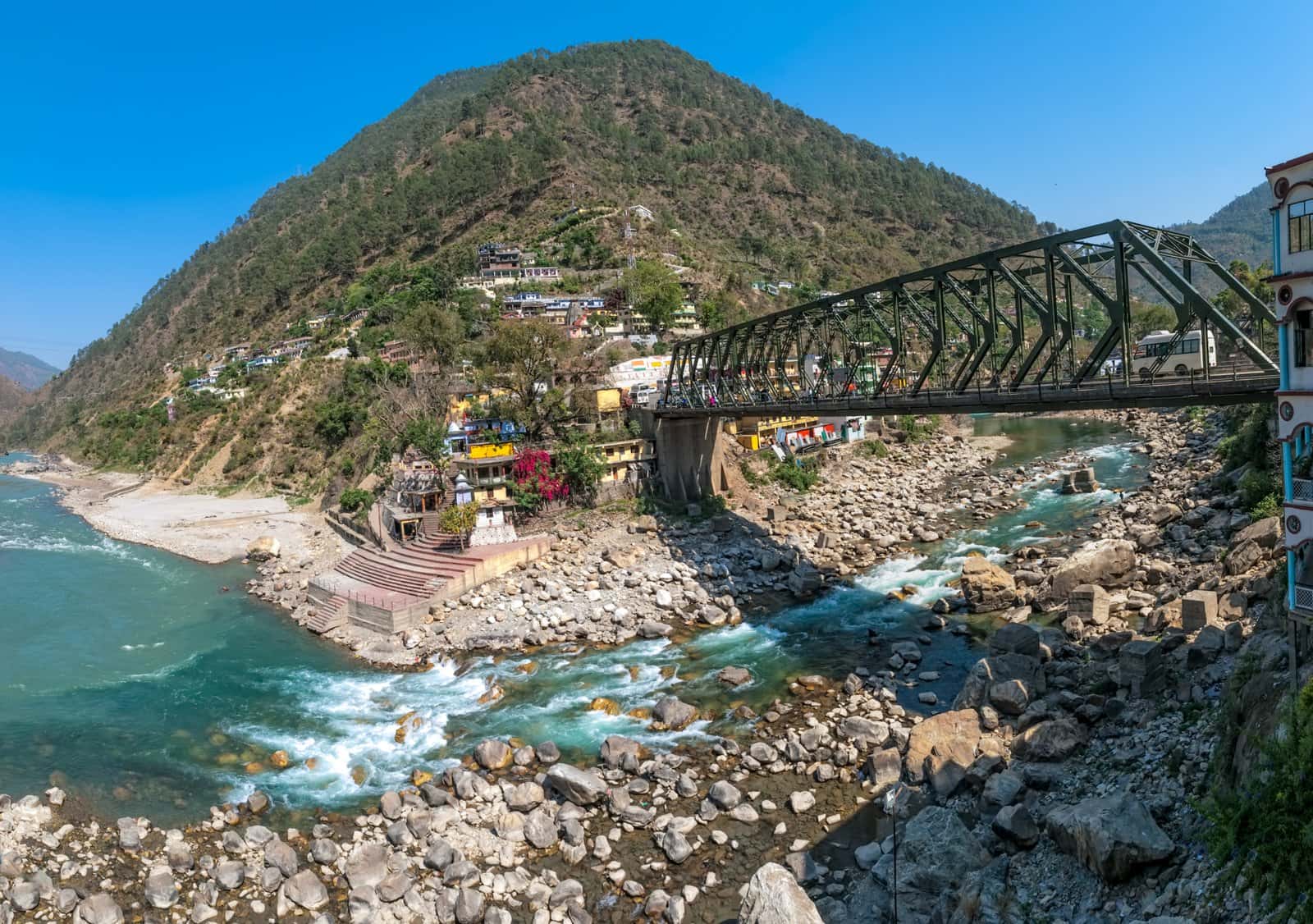
- The Rudraprayag SangamThe confluence where the Mandakini, down from the Kedarnath valley, meets the Alaknanda, down from the Badrinath valley. It is one of the Panch Prayag, the five sacred confluences of the Alaknanda, and the calm ghat at the meeting of the two rivers is the soul of the town. There is no entry fee; pilgrims often pause here for a quiet dip or prayer at the old Rudranath temple beside the water.
- Koteshwar Mahadev cave templeA cave shrine to Lord Shiva on the bank of the Alaknanda, about 3 km from town. Quiet, atmospheric and free to visit, it makes an easy short trip from the sangam, best in the gentle light of morning or late afternoon.
- Dhari Devi templeThe riverside shrine of the goddess Dhari Devi, about 20 km away (and around 15 km from Srinagar Garhwal). The idol was moved to a raised, reconstructed temple in 2013, and the rebuilt shrine over the Alaknanda is what pilgrims visit today. Free to enter; allow time for the drive and the steps down to the river.
- Kartik Swami, for the sunrise viewA temple to Lord Kartikeya on a high ridge, reached by a walk of about 3 km from Kanak Chauri village on the Rudraprayag to Pokhri road, about 38 km from town. Free to visit, it rewards an early start with one of the finest sunrise panoramas in the district, and very few Char Dham itineraries include it.
The sangam, the Koteshwar cave temple, the Dhari Devi shrine, the Kartik Swami ridge and the town temples are all free to enter. Your real costs at Rudraprayag are the road travel, your stay and any guide or pujari you choose to engage. The one thing you must arrange in advance is the free Char Dham registration, covered in the logistics and overseas sections below.
The sangam, the road fork, and the Dhari Devi story
Rudraprayag is the hinge of the Char Dham: two holy rivers join here, and the road to the two great shrines splits here. Understanding this makes the town far more than a refuelling stop.
- Two rivers, one GangaAt the Rudraprayag sangam the Mandakini, born of the Chorabari glacier above Kedarnath, joins the Alaknanda, born above Badrinath. It is the meeting of the two Char Dham river valleys in one place, and the combined waters flow on to become the Ganga at Devprayag downstream. The town sits at about 895 m, lower and warmer than the shrines above.
- The road fork for the yatraJust as the rivers meet here, the roads divide here. The Kedarnath leg turns off toward Guptkashi, Sonprayag and Gaurikund (about 86 km), while the Badrinath leg climbs on up the Alaknanda through Karnaprayag and Joshimath (about 155 to 160 km). Staging your trip from Rudraprayag lets you do both shrines from one familiar base without long backtracking.
- Dhari Devi and the 2013 story, calmlyAbout 20 km away, the riverside Dhari Devi temple is the shrine of the goddess many locals associate with the 2013 disaster. When the idol was moved to a raised, reconstructed temple in 2013 as the Alaknanda rose behind a hydro project, the catastrophic floods followed within days, and the two became linked in popular belief. The rebuilt shrine you visit today stands over the river; we simply share the story as pilgrims tell it, without claiming cause.
- The 2013 floods, in plain termsThe June 2013 Uttarakhand floods, set off by extreme rainfall and a glacial lake burst above Kedarnath around 16 to 17 June, were among India's worst natural disasters, and Rudraprayag district along the Mandakini was among the worst affected. The route has since been rebuilt and re-engineered. The history is why the season, the registration and the night-driving rules are all taken seriously now, and is worth knowing rather than fearing.
Because Rudraprayag is the single point where both the rivers and the roads of the Char Dham meet, it is the natural pivot for a Kedarnath-and-Badrinath trip. Spend a night here, complete or carry your free registration, time your onward drive to beat the night ban, and you can reach either shrine without backtracking far. We build many Char Dham itineraries around exactly this.
Making the most of a Rudraprayag halt
A night at Rudraprayag is not dead time between shrines. Used well, it breaks the long mountain drive and adds quiet, meaningful moments to the yatra.
- Sit by the sangam at dawn or duskWalk down to the confluence ghat in the soft early or late light, when the two rivers meet quietly and the crowds thin. It is the simplest and most memorable thing to do here, and a calm way to mark the midpoint of the yatra.
- Visit Koteshwar MahadevThe riverside cave temple about 3 km from town is an easy, atmospheric short trip, especially in the gentle morning light. A quiet darshan here pairs naturally with the sangam and asks for no more than an hour.
- Catch sunrise at Kartik SwamiIf you have a clear morning and a spare half-day, the short climb of about 3 km from Kanak Chauri to the Kartik Swami ridge rewards you with a sweeping Himalayan sunrise that most yatris never see. Start very early and check the weather, as the ridge is exposed.
- Make the Dhari Devi driveIf you have a half-day, the drive to the Dhari Devi shrine about 20 km away, set over the Alaknanda, is worthwhile. Allow time for the road and the steps down to the river, and go calmly, knowing the story rather than the scare.
- Add Chopta and Tungnath if you have daysOff the Kedarnath road beyond Ukhimath, Chopta (about 2,700 m) is the base for the Tungnath temple and Chandrashila walk (Tungnath at about 3,500 m). It is a beautiful scenic add-on reached via Rudraprayag for travellers with a spare day or two and the legs for a short climb.
- Plan the next morning around the road rulesWhichever shrine is next, time your start so you reach your onward halt before the night-driving ban (about 10 pm to 4 am) and travel the hill bends in daylight. We line up the cars, the timing and the halts so the long legs feel gentle rather than rushed.
If you do only one thing slowly at Rudraprayag, make it the sangam at either end of the day. The confluence of the Mandakini and the Alaknanda, quiet in the early light with the old Rudranath temple beside it, is the emotional heart of the halt and a moment most yatris remember long after the drive blurs together. Give yourself an unhurried hour at the water rather than treating the town only as a stop for fuel and a meal.
Where to stay around Rudraprayag, and how many nights
Stay in or just outside Rudraprayag town for the sangam, or push a little higher to Guptkashi or Sitapur if Kedarnath is your priority. A single night here, used as a staging halt, is usually the right amount.
- Rudraprayag town and riversideSimple hotels, guesthouses and the GMVN (Garhwal Mandal) tourist rest house cluster around the town and the riverside, walkable to the sangam and the bus stand. This is the convenient choice if you are arriving late and pivoting to either shrine the next day. Rooms are basic but clean, and the GMVN restaurant has a pleasant river view.
- GMVN, the official optionGarhwal Mandal Vikas Nigam runs government tourist rest houses at Rudraprayag and along the route (Tilwara, Syalsaur, Guptkashi and more), bookable on the official gmvnonline.com portal. They are dependable, fairly priced and a good fallback when private hotels fill in peak season, though they book out early in May and June.
- Guptkashi or Sitapur for KedarnathIf Kedarnath is your focus, many travellers sleep higher up at Guptkashi or Sitapur, closer to the Sonprayag road-head, rather than at Rudraprayag itself. For a balanced Kedarnath-and-Badrinath trip, though, a Rudraprayag night keeps you at the fork and serves both directions.
- How many nightsOne night at Rudraprayag is usually enough, used as a staging halt to break the long drive and reset before the next leg. Add a second only if you want the Kartik Swami sunrise, the Dhari Devi drive or a Chopta side-trip. The full Char Dham circuit typically runs about 10 to 12 days, and a Kedarnath-and-Badrinath (Do Dham) trip about 6 to 8 days, with Rudraprayag one halt within it.
In May and June, and again in the September to October window, hotels and GMVN rest houses along the Char Dham route fill weeks ahead and rates rise. If your dates fall in the peak, book your Rudraprayag and Guptkashi nights early, or let us hold confirmed rooms as part of the itinerary so you are not hunting for a bed after a long mountain drive.
Costs and budget: the trek, the helicopter and the halt
Rudraprayag itself is cheap, since its sights are free. The real Char Dham costs are the long-distance car, your stays, and the Kedarnath leg, where the choice between trekking, a pony and the helicopter sets your budget.
- The free partAll the Rudraprayag sights, the sangam, Koteshwar, Dhari Devi, Kartik Swami and the town temples, are free to enter, and so is the mandatory Char Dham registration. Be wary of any agent who asks for a fee just to do the basic registration, which is genuinely free on the official portal.
- The Kedarnath helicopterIf you fly to Kedarnath, the helicopter runs from Guptkashi, Phata and Sersi and is sold only on the official IRCTC HeliYatra portal. For 2026 reported one-way fares were about 3,043 rupees from Sersi, about 4,840 rupees from Phata and about 6,077 rupees from Guptkashi, plus a small convenience fee and GST. Treat these as indicative, confirm the current fare on the portal, and never pay a tout a premium for off-portal seats.
- Ponies, palki and portersOn the Gaurikund-to-Kedarnath trek you can hire a pony, a palki (palanquin carried by porters) or a porter for bags, useful for seniors or anyone unsure of the climb. Rates are set seasonally and quoted at the road-head; agree the price and the service in advance, and budget separately from the helicopter.
- The rest of the budgetYour main costs are the long-distance car with a certified hill driver, your nightly stays (basic hotels and GMVN rest houses are inexpensive, rising in peak season), meals (simple vegetarian dhabas along the route) and any pujari or guide. We give a clear, itemised quote so there are no surprises on the road.
The single budget rule that also protects you from fraud: the Kedarnath helicopter is sold online only on heliyatra.irctc.co.in, and the portal itself warns against touts and fake agents. Anyone promising guaranteed seats off-portal at a premium is a risk. Hold the fares above as indicative for 2026, reconfirm on the portal before you book, and keep the convenience fee and GST in mind on top of the base fare.
Practical logistics: registration, food, money and signal
The small things that keep a Char Dham day smooth, from the mandatory registration and the night-driving ban to food, ATMs and mobile signal on the mountain road.
- Do the registration, carry the QR passThe free Char Dham registration on registrationandtouristcare.uk.gov.in is mandatory before the route and is Aadhaar-linked. Complete it for everyone in your group, save the QR e-pass on your phone and print a copy, because it is checked at points along the way to Kedarnath and Badrinath. Carry photo ID and several photocopies for registrations and hotel check-ins.
- Plan daylight legs, food and waterVehicles are banned on the route at night, about 10 pm to 4 am, so plan to drive the bends in daylight and reach each halt before dark. Food along the way is simple vegetarian dhaba fare; carry dry fruit, glucose and chocolate for energy, drink only sealed bottled water, and avoid uncertain roadside food, especially before the high legs.
- Money and ATMsRudraprayag town has banks and ATMs, but smaller stops higher up may not, so draw enough cash at Rishikesh, Haridwar or Rudraprayag for the days ahead. Carry cash for dhabas, ponies, porters and small shops, as cards and UPI are not reliable on the upper route.
- Mobile signal and packingCoverage on the Char Dham road is patchy; BSNL and Jio tend to work best, and signal thins as you climb toward the shrines. Pack warm layers even in summer, rain gear in the monsoon shoulders, good walking shoes, sunscreen, a torch and any prescribed medicines, since the weather higher up can change fast.
On our Char Dham trips we handle the registration guidance, a route-compliant vehicle with a certified hill driver, the daylight-paced legs that respect the night ban, and confirmed halts at the river towns. The drivers know the bends, the dhabas and the weather patterns, which on this road is worth more than any single saving.
Safety, altitude, monsoon and the scams to avoid
Rudraprayag is low and gentle, but the shrines above it are high and the road is mountainous. Honest care with altitude, weather and a couple of common scams keeps the yatra safe.
- Altitude on the Kedarnath and Badrinath legsRudraprayag at about 895 m is easy, but Kedarnath (about 3,580 m) and Badrinath (about 3,100 m) are high. Ascend gradually, keep hydrated, walk slowly on the trek, and watch for headache, nausea or breathlessness. For 2026 authorities advise health checks before the high shrines, especially for the elderly; get a doctor's clearance and carry prescribed medicines.
- Monsoon, landslides and the 2013 lessonFrom July to early September the routes are prone to landslides and the yatra is sometimes halted when rain is heavy; the 2013 floods are the reason the rules exist. Watch official weather and road updates, keep your plan flexible, never push on through heavy rain, and respect barriers and turbulent rivers rather than stopping for photos on unstable ground.
- The two scams to refuseNever pay an agent a fee for the basic Char Dham registration, which is free on the official portal, and never buy Kedarnath helicopter seats off the IRCTC HeliYatra portal, however confident the seller sounds. Both are common traps on this route; the official channels are free or fixed and clearly published.
- Drive safe, walk safeUse a route-compliant vehicle and a certified hill driver, do not drive at night, and do not pressure a tired driver to make up time. On the Kedarnath trek, start early, keep to the path, hire a pony or porter if unsure, and turn back in bad weather. Travel insurance that includes high-altitude medical evacuation is genuinely worth it here.
Rudraprayag is low and easy, but Kedarnath and Badrinath are high-altitude shrines reached by long mountain drives and, for Kedarnath, a steep trek. Do not skip acclimatisation or, for elderly pilgrims, a medical check, and do not assume last year's opening dates, fares or rules. Confirm the current 2026 dates, fares and vehicle requirements before you commit, and build the day around the night-driving ban.
Rudraprayag and the Char Dham for every kind of traveller
Different pilgrims need different plans for the two-shrine yatra. Here is what matters most for each, with Rudraprayag as your staging base, including how a senior travels comfortably.
- Senior travellers and on accessibilityUse Rudraprayag as a gentle low halt at about 895 m to break the long drives. Get a doctor's clearance before the high shrines, consider the Kedarnath helicopter or a pony rather than the full trek, time the legs to beat the night-driving ban, carry prescribed medicines, and make sure your travel cover includes high-altitude medical evacuation for the Kedarnath and Badrinath legs.
- Families with childrenPace the journey through the river towns rather than rushing shrine to shrine. A relaxed night at Rudraprayag, an evening at the sangam and an early, daylight start the next morning make the mountain legs far easier for little ones, and keep a child's hand firmly held near the fast rivers.
- Couples and devoteesA quiet, meaningful midpoint to the yatra, with beautiful Himalayan mornings and the two rivers meeting at the ghat. An evening at the sangam, a Kartik Swami sunrise and an early onward start make a memorable, unhurried trip.
- First-time Himalayan pilgrimsUnderstand that Rudraprayag is the fork, not a shrine: the Kedarnath and Badrinath roads split here. Do the free registration early, decide your shrine order in advance, learn the night-driving ban and the 2026 vehicle rules, and build in the night halts so the long drives and the altitude higher up do not surprise you.
- Trekkers and the activeUse Rudraprayag to reach Chopta for the Tungnath and Chandrashila walk, or to do the Kedarnath trek from Gaurikund (about 16 km each way) on foot. Acclimatise sensibly, start early, and check the weather window before you set out for the higher meadows.
Where Rudraprayag fits in a Char Dham itinerary
How to slot a Rudraprayag halt into a Kedarnath-and-Badrinath trip or the full Char Dham, so the long mountain legs stay gentle and you reach each halt in daylight.
- Day one: plains to RudraprayagFrom Rishikesh, Haridwar or Dehradun, drive up the Char Dham highway through Devprayag, reaching Rudraprayag in about 5 to 7 hours and well before the night ban. Settle in, walk down to the sangam at dusk, and rest before the next leg. This breaks what would otherwise be a punishing single push to the shrines.
- Day two: the Kedarnath legFrom Rudraprayag the road turns off for Guptkashi, Sonprayag and Gaurikund. Sleep at Guptkashi or Sitapur, then trek about 16 km from Gaurikund to Kedarnath, or take the helicopter from Guptkashi, Phata or Sersi. Give Kedarnath two days if you can, as the trek and darshan are tiring.
- Day three onward: the Badrinath legReturn to the Alaknanda valley and continue up through Karnaprayag and Joshimath to Badrinath (about 155 to 160 km from Rudraprayag), again with a daylight-paced drive and a night halt on the way. Mana village, just beyond Badrinath, makes a fine add-on.
- How long overallA Kedarnath-and-Badrinath (Do Dham) trip works in about 6 to 8 days; the full Char Dham, adding Yamunotri and Gangotri, typically runs about 10 to 12 days. In either, Rudraprayag is the natural staging halt at the fork rather than a destination in itself.
The single thing that breaks a Char Dham plan is starting a leg too late and being caught by the night-driving ban (about 10 pm to 4 am) with hours of mountain road still ahead. Build each day so you reach your halt in daylight, keep the early morning for the hard legs, and never try to make up lost time after dark on these bends. A Rudraprayag night exists precisely to make this possible.
The real questions Char Dham travellers ask about Rudraprayag
Straight answers to the questions that come up again and again on traveller forums, so you arrive already knowing the score.
- Is Rudraprayag worth a stop?Yes, as a staging halt. It is the fork where the Kedarnath and Badrinath roads split and the sacred sangam of two rivers, so a night here breaks the long drive and gives a quiet, meaningful pause. As a standalone destination it is modest; as the pivot of a two-shrine trip it is ideal.
- Should I base both shrines from here?Rudraprayag is the natural pivot, but for the Kedarnath leg most travellers sleep higher at Guptkashi or Sitapur, near the road-head, then return to the Alaknanda valley for Badrinath. Use Rudraprayag as the staging night at the fork rather than as the base for both climbs.
- How long is the Kedarnath trek?From Gaurikund it is commonly quoted at about 16 km each way after the 2013 rebuild (older sources say 14 km, some still say up to 18 km), taking most fit walkers about 6 to 9 hours up. Ponies, palki porters and the helicopter are alternatives for those who cannot do the full climb.
- Is the helicopter worth it, and where do I book?For seniors, tight schedules or anyone unsure of the trek, yes. Book only on the official IRCTC HeliYatra portal, heliyatra.irctc.co.in; for 2026 one-way fares ran about 3,043 rupees from Sersi, about 4,840 from Phata and about 6,077 from Guptkashi, plus fees and GST. Never buy off-portal from a tout.
- Do I really need the registration?Yes. The free Char Dham registration on registrationandtouristcare.uk.gov.in is mandatory and Aadhaar-linked, and a QR e-pass is checked on the route, so without it you are turned back. It is genuinely free, so never pay an agent a fee just to register.
- Is the man-eating leopard a real place?Yes. This is the Rudraprayag of Jim Corbett's famous book; between about 1918 and 1926 a single leopard killed about 125 people along the old pilgrim road before Corbett shot it on 2 May 1926. It is a piece of local history now, not a present-day danger, and the modern road is a world away from that era.
Planning the Char Dham from abroad, with Rudraprayag as your hinge
For NRI and OCI families, Rudraprayag is the practical pivot for a Kedarnath-and-Badrinath trip. Three things make it smooth: the free registration done first, the road fork understood, and real altitude care for elderly parents.
- Do the free registration before anything elseEvery pilgrim heading to Kedarnath or Badrinath needs the free, Aadhaar-linked Char Dham registration at registrationandtouristcare.uk.gov.in. Complete it for the whole family in advance and keep the QR e-passes handy, as they are checked on the route. Carry passports, and OCI cardholders should carry the physical card with the linked passport. We can help you register correctly from abroad.
- Use the road fork to your advantageRudraprayag is the single point where the Kedarnath and Badrinath roads split, so a base here lets you do both shrines without long backtracking. Kedarnath turns off toward Guptkashi and Gaurikund (about 86 km), Badrinath climbs on through Joshimath (about 155 to 160 km). We sequence the two legs around your family's pace and the 2026 vehicle rules.
- Mind the altitude and the road rulesRudraprayag itself is low and easy at about 895 m, but Kedarnath (about 3,580 m) and Badrinath (about 3,100 m) are high, so parents flying in from sea level should get a doctor's clearance and acclimatise sensibly; for 2026 health checks are advised before the high shrines. Remember too that the hill roads ban night driving (about 10 pm to 4 am), so plan daylight legs.
- Consider the helicopter for eldersFor older parents the Kedarnath helicopter from Guptkashi, Phata or Sersi saves the long trek; book it only on the official IRCTC HeliYatra portal, never from an agent promising off-portal seats. For 2026 one-way fares ran from about 3,043 rupees, plus fees and GST, so factor it into the family budget and book early in the season.
A first Himalayan pilgrimage for overseas families
For an overseas family doing its first Himalayan yatra, the mountain is the real variable. Pace, acclimatisation, the right vehicle and an honest read on the season matter more than ticking off both shrines fast.
- Let Rudraprayag be your unhurried baseRather than rushing from the plains to the shrines in one go, build in a night at Rudraprayag at about 895 m. It breaks the long drive, sits at the sangam where the two holy rivers meet, and pivots neatly to either shrine. For 2026 plan around Kedarnath opening about 22 April and Badrinath about 23 April, and reconfirm before booking.
- Time it to the settled windowsAim for May to June or September to October, the most settled stretches, and avoid the peak monsoon (July to early September) when landslides can halt the yatra. If your only window is the monsoon shoulder, keep the plan flexible and watch official road updates, as the mountain decides the schedule, not the calendar.
- Money, SIM and connectivityPick up an Indian tourist SIM or eSIM when you land in Delhi or Dehradun; BSNL and Jio work best on the route, though signal thins higher up. Draw cash in the plains or at Rudraprayag, since cards and UPI are unreliable on the upper road, and carry small notes for dhabas, ponies and porters.
- Pack and plan for the mountainCarry warm layers even in summer, rain gear in the shoulders, sturdy walking shoes, sunscreen, a torch and any prescribed medicines. Eat the simple vegetarian dhaba food, drink only sealed bottled water, and avoid alcohol and heavy meals before the high legs. A measured, daylight-paced trip beats a rushed one every time on this road.
Many overseas families arrive expecting a fast circuit and find that the mountain sets its own pace. Give the yatra room: a night at Rudraprayag, daylight legs, the helicopter for elders who need it, and an honest read on the weather. Plan it this way and the Char Dham becomes the calm, profound trip it is meant to be, rather than an exhausting dash between two distant shrines.
The legend of Narada, the Veena, and Shiva as Lord of Music
Rudraprayag takes its name from Rudra, a fierce form of Lord Shiva. In the old story the sage Narada, proud of his skill on the Veena, came to this confluence and met a band of celestial musicians, the raginis, left disfigured, it is said, by his unschooled playing. Humbled, Narada surrendered before Shiva and begged to learn music properly. Shiva appeared here in his Rudra form, the Lord of Music, and taught the chastened sage. The old Rudranath temple beside the meeting of the Mandakini and the Alaknanda marks the spot, and a rock once known as Narad Shila is tied to the same legend. It is a fitting story for a place where two rivers learn to flow as one. As with most temple legends, it is carried in regional tradition rather than fixed to a single scriptural verse, and we tell it as pilgrims and local histories tell it.
Planning a Rudraprayag trip?
Our Uttarakhand travel experts plan your full journey for you: route, hotels, darshan timings and transport. You get a free day-by-day plan and an exact quote on WhatsApp, usually within a few hours. No payment is needed to get your plan.
Tour packages that visit Rudraprayag
Every journey below is private, hand-crafted and fully customizable. Tell us your dates and we tailor the itinerary, the pace and the priests or guides around you.
 4D / 3N
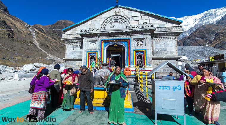
Kedarnath Jyotirlinga Tour Package
- Visit Mansa Devi Temple
- Visit Chandi Devi Temple
 19D / 18N
12 Jyotirlinga Tour Package from Delhi
- All Jyotirlinga darshans
- Ganga Aarti experiences